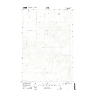
2014 Map of Saint Anthony
USGS Topo · Published 2014About this map
Saint Anthony anchors the northern edge of this Morton County landscape, situated amidst the high plains where the drainage systems of the Little Heart River begin their descent. The terrain is defined by the winding paths of the S Br Little Heart River and the Southeast Br Little Heart River, which carve through the undulating topography typical of this region south of Mandan. To the northwest, the level expanse of Little Heart Flats provides a stark contrast to the more dissected coulees and ridges found further south. The map illustrates a strictly organized section-line road network, where routes like 25th Ave and 58th St intersect the rural landscape, facilitating access to the scattered farmsteads and agricultural holdings that have sustained this community for generations.
Find a feature on this map
18 named features on this map. Tap any name to fly to it.
Don’t see what you’re looking for? This feature index may not catch every label — zoom into the map to look around manually.
Map Details
Editions of this 2014 Saint Anthony Map
This is the sole edition of this map. No revisions or reprints were ever made.
Other maps of this area

1907 · Bismarck
USGS Topo · 1:125,000

1954 · Bismarck
USGS Topo · 1:250,000

1958 · Bismarck
USGS Topo · 1:250,000

1962 · Schmidt
USGS Topo · 1:24,000

1979 · Bismarck
USGS Topo · 1:100,000

1980 · Solen
USGS Topo · 1:24,000
1980 · The Hogback
USGS Topo · 1:24,000

1980 · Breien
USGS Topo · 1:24,000

1980 · Fallon NE
USGS Topo · 1:24,000

1980 · Burgess
USGS Topo · 1:24,000