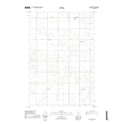
2020 Map of Saint Anthony
USGS Topo · Published 2020About this map
Saint Anthony serves as the primary focal point of this Morton County landscape, a small community anchored by the Saint Anthony Catholic Ch and the adjacent Saint Anthony Catholic Cem. The terrain is defined by the branching drainages of the S Br Little Heart River and the Southeast Br Little Heart River, which carve through the high plains of central North Dakota. In the southern portion of the map, the headwaters of the E Fork Chanta Peta Cr emerge, illustrating the continental divide and drainage patterns of the Missouri River watershed. The map records a rectilinear grid of section lines and rural routes, such as Co RD 136 and Co RD 82, which facilitate the region's agricultural transport network.
Find a feature on this map
24 named features on this map. Tap any name to fly to it.
Don’t see what you’re looking for? This feature index may not catch every label — zoom into the map to look around manually.
Map Details
Editions of this 2020 Saint Anthony Map
This is the sole edition of this map. No revisions or reprints were ever made.
Other maps of this area

1907 · Bismarck
USGS Topo · 1:125,000

1954 · Bismarck
USGS Topo · 1:250,000

1958 · Bismarck
USGS Topo · 1:250,000

1962 · Schmidt
USGS Topo · 1:24,000

1979 · Bismarck
USGS Topo · 1:100,000

1980 · Solen
USGS Topo · 1:24,000
1980 · The Hogback
USGS Topo · 1:24,000

1980 · Breien
USGS Topo · 1:24,000

1980 · Fallon NE
USGS Topo · 1:24,000

1980 · Burgess
USGS Topo · 1:24,000