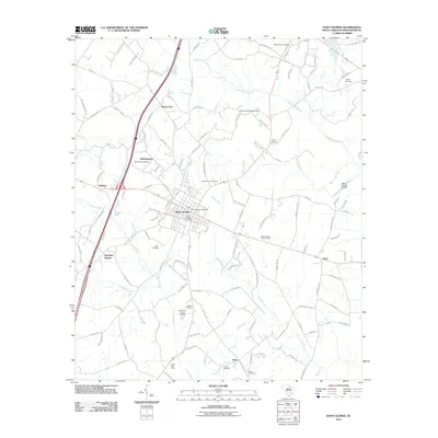
2011 Map of Saint George
USGS Topo · Published 2011About this map
Saint George serves as the central hub of this Dorchester County landscape, situated at the intersection of significant rail and road corridors. The surrounding countryside is dotted with long-standing community landmarks, including the Indian Field Campground and numerous family and church burial grounds such as Indian Ferry Cemetery and Good Hope Cemetery. Waterways like Indian Field Swamp and Polk Swamp define the low-lying drainage patterns that have historically shaped local land use and settlement. To the south, the Dorchester Fish Hatchery and Grover Post Office indicate the continued importance of specialized state and federal services in this rural area. Smaller communities like Hudsontown, Badham, and Texas appear as distinct clusters, while the Saint George Airport and Saint George Lookout Tower highlight the region's modern infrastructure and forestry management tools.
Find a feature on this map
124 named features on this map. Tap any name to fly to it.
Don’t see what you’re looking for? This feature index may not catch every label — zoom into the map to look around manually.
Map Details
Editions of this 2011 Saint George Map
This is the sole edition of this map. No revisions or reprints were ever made.
Other maps of this area

1919 · Ridgeville
USGS Topo · 1:48,000

1920 · Eutawville
USGS Topo · 1:48,000

1920 · Bowman
USGS Topo · 1:48,000

1920 · Ridgeville
USGS Topo · 1:62,500

1920 · St. George
USGS Topo · 1:48,000

1921 · Bowman
USGS Topo · 1:62,500

1921 · St. George
USGS Topo · 1:62,500

1921 · Eutawville
USGS Topo · 1:62,500

1943 · Bowman
USGS Topo · 1:62,500

1943 · Orangeburg
USGS Topo · 1:125,000