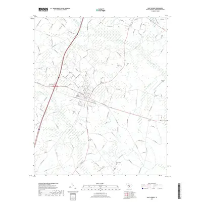
2017 Map of Saint George
USGS Topo · Published 2017About this map
Saint George serves as the focal point of this Lowcountry survey, where the Norfolk Southern line cuts through a landscape defined by the drainage of Indian Field Swamp and Polk Swamp. The settlement pattern is deeply connected to these water systems, with numerous small burial grounds such as Saint James Cem and Good Hope Cem marking the historical distribution of local families throughout the area. In the outlying sections, the communities of Badham to the west and Byrd to the east sit along the primary road and rail corridors that have historically facilitated the region's movement.
Find a feature on this map
144 named features on this map. Tap any name to fly to it.
Don’t see what you’re looking for? This feature index may not catch every label — zoom into the map to look around manually.
Map Details
Editions of this 2017 Saint George Map
This is the sole edition of this map. No revisions or reprints were ever made.
Other maps of this area

1919 · Ridgeville
USGS Topo · 1:48,000

1920 · Eutawville
USGS Topo · 1:48,000

1920 · Bowman
USGS Topo · 1:48,000

1920 · Ridgeville
USGS Topo · 1:62,500

1920 · St. George
USGS Topo · 1:48,000

1921 · Bowman
USGS Topo · 1:62,500

1921 · St. George
USGS Topo · 1:62,500

1921 · Eutawville
USGS Topo · 1:62,500

1943 · Bowman
USGS Topo · 1:62,500

1943 · Orangeburg
USGS Topo · 1:125,000