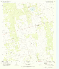
1973 Map of Saint Lawrence
USGS Topo · Published 1976About this map
Saint Lawrence serves as the central hub of this West Texas landscape, positioned at the intersection of local routes in the early 1970s. The settlement's agricultural and industrial character is evidenced by the presence of a Grain Elevator and a nearby Landing Strip, reflecting the logistical needs of remote farming and ranching operations. To the south, the terrain transitions into an active Oil Field, where a network of wells and a Pipeline trace the energy development across the Glasscock Co Reagan Co line.
Find a feature on this map
11 named features on this map. Tap any name to fly to it.
Don’t see what you’re looking for? This feature index may not catch every label — zoom into the map to look around manually.
Map Details
Editions of this 1973 Saint Lawrence Map
This is the sole edition of this map. No revisions or reprints were ever made.
Other maps of this area

1954 · San Angelo
USGS Topo · 1:250,000

1958 · San Angelo
USGS Topo · 1:250,000

1963 · Garden City
USGS Topo · 1:24,000

1965 · San Angelo
USGS Topo · 1:250,000

1965 · Dewey Lake SE
USGS Topo · 1:24,000

1965 · Patterson Lake
USGS Topo · 1:24,000

1973 · Saint Lawrence SE
USGS Topo · 1:24,000

1973 · Bigby Corner
USGS Topo · 1:24,000
1973 · Slager Lake
USGS Topo · 1:24,000
1973 · Three Bluff Draw NW
USGS Topo · 1:24,000