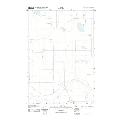
2010 Map of Saint Martin
USGS Topo · Published 2010About this map
The settlement of Saint Martin anchors the southern edge of this Central Minnesota landscape, situated along a bend of the Sauk River. This area is characterized by a dense grid of rural corridors like County Hwy-11 and County Hwy-176 that connect various glacial lakes and water bodies. The presence of Saint Martin Cemetery and Immanuel Cemetery provides significant points of interest for genealogists tracing local families in the township. The northern terrain is defined by several distinct basins, including Lake Maria, Getchell Lake, and Sand Lake, which are drained by Getchell Creek and the engineered County Ditch Number Fifteen. This survey illustrates a well-established agricultural community with a concentrated village center around the Saint Martin Post Office, illustrating the 21st-century configuration of these longstanding Stearns County landmarks.
Find a feature on this map
44 named features on this map. Tap any name to fly to it.
Don’t see what you’re looking for? This feature index may not catch every label — zoom into the map to look around manually.
Map Details
Editions of this 2010 Saint Martin Map
This is the sole edition of this map. No revisions or reprints were ever made.
Other maps of this area

1953 · Saint Cloud
USGS Topo · 1:250,000

1957 · Saint Cloud
USGS Topo · 1:250,000

1958 · Saint Cloud
USGS Topo · 1:250,000

1965 · Albany
USGS Topo · 1:24,000

1965 · Farming
USGS Topo · 1:24,000

1965 · Greenwald
USGS Topo · 1:24,000

1965 · Melrose
USGS Topo · 1:24,000

1965 · Freeport
USGS Topo · 1:24,000

1965 · St Martin
USGS Topo · 1:24,000

1967 · Paynesville
USGS Topo · 1:24,000