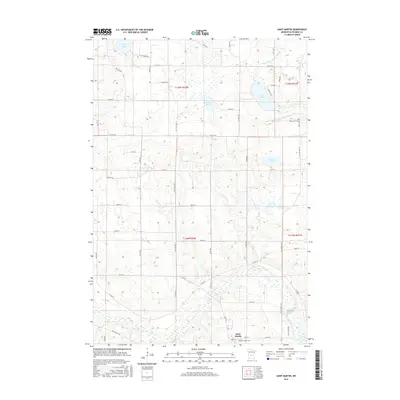
2016 Map of Saint Martin
USGS Topo · Published 2016About this map
Saint Martin serves as the primary hub of this central Minnesota landscape, where the southern portion of the map is defined by the winding course of the Sauk River. The terrain transitions into a glaciated lake country further north, characterized by several notable water bodies including Getchell Lake, Sand Lake, and Gravel Lake. This 2016 survey illustrates a well-defined grid of township roads and county highways that link the agricultural parcels surrounding the village. Local history is anchored by the presence of Saint Martin Cem and Immanuel Cem, while the drainage of the fertile prairie is managed through engineered features like County Ditch Number Fifteen and County Ditch Number Six. The map documents the persistent rural character of Stearns County, showcasing the relationship between the natural wetlands and the managed agricultural infrastructure of the early 21st century.
Find a feature on this map
56 named features on this map. Tap any name to fly to it.
Don’t see what you’re looking for? This feature index may not catch every label — zoom into the map to look around manually.
Map Details
Editions of this 2016 Saint Martin Map
This is the sole edition of this map. No revisions or reprints were ever made.
Other maps of this area

1953 · Saint Cloud
USGS Topo · 1:250,000

1957 · Saint Cloud
USGS Topo · 1:250,000

1958 · Saint Cloud
USGS Topo · 1:250,000

1965 · Albany
USGS Topo · 1:24,000

1965 · Farming
USGS Topo · 1:24,000

1965 · Greenwald
USGS Topo · 1:24,000

1965 · Melrose
USGS Topo · 1:24,000

1965 · Freeport
USGS Topo · 1:24,000

1965 · St Martin
USGS Topo · 1:24,000

1967 · Paynesville
USGS Topo · 1:24,000