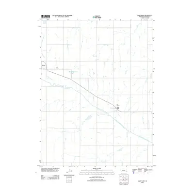
2012 Map of Saint Mary
USGS Topo · Published 2012About this map
Sterling and the crossroads community of Saint Mary anchor this 2012 survey of the Nebraska prairie. The landscape is defined by the winding course of the North Fork Big Nemaha River, which is fed by numerous tributaries including Pratts Branch, Saunders Creek, and Beatty Creek. This agricultural region in Johnson County is organized by a strict section-line road grid, with routes like Prairie Dr and S 20th Rd providing access to the fertile lands between the river and its creeks.
Find a feature on this map
16 named features on this map. Tap any name to fly to it.
Don’t see what you’re looking for? This feature index may not catch every label — zoom into the map to look around manually.
Map Details
Editions of this 2012 Saint Mary Map
This is the sole edition of this map. No revisions or reprints were ever made.
Other maps of this area

1903 · Weeping Water
USGS Topo · 1:125,000

1929 · Weeping Water
USGS Topo · 1:125,000

1955 · Lincoln
USGS Topo · 1:250,000

1957 · Lincoln
USGS Topo · 1:250,000

1958 · Lincoln
USGS Topo · 1:250,000

1965 · Crab Orchard
USGS Topo · 1:24,000

1965 · Sterling
USGS Topo · 1:24,000

1965 · Tecumseh
USGS Topo · 1:24,000
1965 · Douglas
USGS Topo · 1:24,000
1965 · Tecumseh NW
USGS Topo · 1:24,000