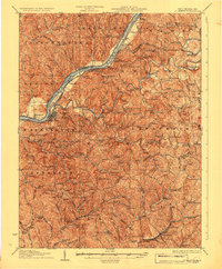
1927 Map of Saint Marys
USGS Topo · Published 1927About this map
St Marys serves as the focal point along the Ohio River in this 1920s-era topographical study, where the Baltimore and Ohio railroad tracks follow the river's bend past Grape Island and Raven Rock. The landscape is defined by the winding course of Middle Island Creek and the North Fork Hughes River, which carve through the townships of Union, Lafayette, and Clay. Local geography is densely marked by a network of rural education and worship, including the Willow Island School, Mt Carmel Church, and Nine-mile School.
Find a feature on this map
140 named features on this map. Tap any name to fly to it.
Don’t see what you’re looking for? This feature index may not catch every label — zoom into the map to look around manually.
Map Details
Editions of this 1927 Saint Marys Map
3 editions found
Other maps of this area

1903 · Macksburg
USGS Topo · 1:62,500

1904 · Marietta
USGS Topo · 1:62,500

1905 · West Union
USGS Topo · 1:62,500

1905 · New Matamoras
USGS Topo · 1:62,500

1905 · Macksburg
USGS Topo · 1:62,500

1906 · Saint Marys
USGS Topo · 1:62,500

1906 · Holbrook
USGS Topo · 1:62,500

1906 · Elizabeth
USGS Topo · 1:62,500

1906 · New Martinsville
USGS Topo · 1:62,500

1907 · Harrisville
USGS Topo · 1:62,500