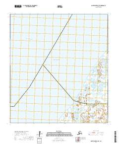
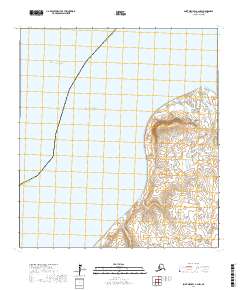
2017 Map of Saint Michael B-2 SE
USGS Topo · Published 2017About this map
Norton Sound meets the complex delta systems of western Alaska in this coastal survey, where the waters of the Pacific Ocean reach into the Bering Sea. The landscape is defined by the slow, meandering paths of the Kogok River and the Pikmiktalik River, which weave through a low-lying terrain of wetlands and seasonal waterways. This remote interface between land and sea serves as a critical boundary point, marked by the intersection of the Nome Census Area and the Kusilvak Census Area. The absence of roads or permanent settlements highlight the maritime and river-based nature of travel in this region, where the hydrology of the coastal plains dictates the movement of people and wildlife along the riverbanks and through the tidal flats.
Find a feature on this map
12 named features on this map. Tap any name to fly to it.
Don’t see what you’re looking for? This feature index may not catch every label — zoom into the map to look around manually.
Map Details
Editions of this 2017 Saint Michael B-2 SE Map
This is the sole edition of this map. No revisions or reprints were ever made.
Other maps of this area

1951 · St Michael
USGS Topo · 1:250,000
1952 · Saint Michael B-2
USGS Topo · 1:63,360

1952 · Saint Michael B-1
USGS Topo · 1:63,360

1952 · Saint Michael A-1
USGS Topo · 1:63,360

1952 · Saint Michael A-2
USGS Topo · 1:63,360

1952 · St Michael
USGS Topo · 1:250,000

1964 · St. Michael
USGS Topo · 1:250,000
2017 · Saint Michael A-2 NE
USGS Topo · 1:25,000
2017 · Saint Michael A-1 NW
USGS Topo · 1:25,000
2017 · Saint Michael A-2 NW
USGS Topo · 1:25,000