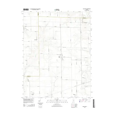
2015 Map of Saint Rose
USGS Topo · Published 2015About this map
Saint Rose anchors this section of Clinton County, where the agricultural grid meets the winding drainage systems of the Central Illinois prairie. The map documents a series of established communities including Jamestown, Sebastopol, and the northern edges of Aviston and Breese. These settlements are linked by a dense network of country roads such as Keyesport Rd and St Rose Rd, which navigate around the natural incisions of Spanker Br and Lake Br.
Find a feature on this map
74 named features on this map. Tap any name to fly to it.
Don’t see what you’re looking for? This feature index may not catch every label — zoom into the map to look around manually.
Map Details
Editions of this 2015 Saint Rose Map
This is the sole edition of this map. No revisions or reprints were ever made.
Other maps of this area

1906 · Breese
USGS Topo · 1:62,500

1907 · Breese
USGS Topo · 1:62,500

1910 · Carlyle
USGS Topo · 1:62,500

1932 · Greenville
USGS Topo · 1:62,500

1937 · New Douglas
USGS Topo · 1:48,000

1939 · Greenville
USGS Topo · 1:62,500

1943 · Greenville
USGS Topo · 1:62,500

1944 · New Douglas
USGS Topo · 1:62,500

1948 · Carlyle
USGS Topo · 1:62,500
1957 · Highland
USGS Topo · 1:24,000