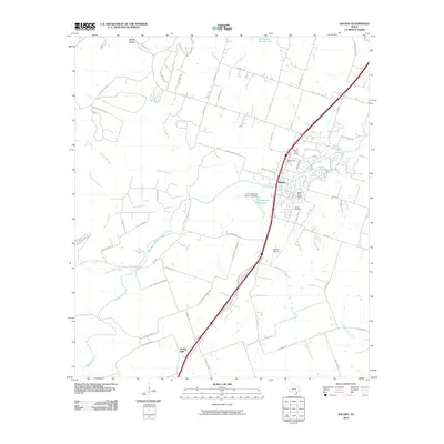
2010 Map of Salado
USGS Topo · Published 2010About this map
Salado serves as the central hub of this Bell County landscape, positioned along a major transit corridor during a period of steady residential and suburban expansion. The historic character of the town is anchored by the Salado Cemetery and the Salado Post Office, while modern infrastructure is represented by the Salado Water Tower and the Salado Airport to the south. The surrounding terrain is defined by the winding course of Salado Creek and its many tributaries, including Buttermilk Creek and Willingham Branch. To the north, the waters of Stillhouse Hollow Lake reach into the quadrangle, highlighting the area's transition from traditional ranching lands to a modern community. Notable landmarks such as the E S C Robertson Ranch Lake Dam and the settlement of Prairie Dell illustrate the local land-use patterns, where water management and historic road networks like Thomas Arnold Rd shape the layout of the region.
Find a feature on this map
64 named features on this map. Tap any name to fly to it.
Don’t see what you’re looking for? This feature index may not catch every label — zoom into the map to look around manually.
Map Details
Editions of this 2010 Salado Map
This is the sole edition of this map. No revisions or reprints were ever made.
Other maps of this area

1885 · Taylor
USGS Topo · 1:125,000

1887 · Taylor
USGS Topo · 1:125,000

1892 · Temple
USGS Topo · 1:125,000

1893 · Georgetown
USGS Topo · 1:125,000

1894 · Gatesville
USGS Topo · 1:125,000

1894 · Taylor
USGS Topo · 1:125,000

1924 · Gatesville 4-d
USGS Topo · 1:48,000

1924 · Temple 3-C
USGS Topo · 1:48,000

1930 · Killeen
USGS Topo · 1:62,500

1931 · Belton
USGS Topo · 1:62,500