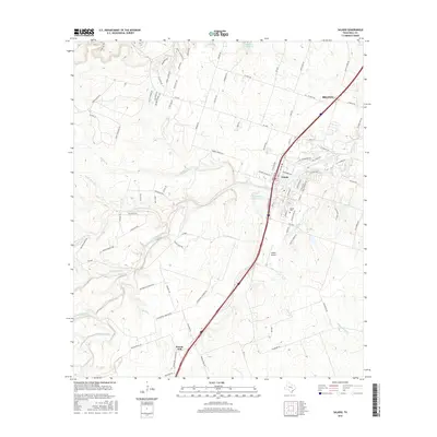
2016 Map of Salado
USGS Topo · Published 2016About this map
Salado is the central hub of this Bell County landscape, situated along the banks of Salado Creek where the local transportation network of the 21st century converges. The historic village character is evidenced by the Salado Cem and a dense network of roads like Thomas Arnold Rd and N Main St that radiate from the town center. To the south, the settlement of Prairie Dell sits near the headwaters of S Darrs Cr, while the northern edge of the map reaches the southeastern limits of Belton. The area is defined by its complex drainage systems, including Willingham Br, Buttermilk Cr, and Mustang Cr, which feed into the primary creek system. Private ranching legacies are visible through features like E S C Robertson Ranch Lake, while modern aviation needs are met by the Salado Airport located east of the main interstate corridor.
Find a feature on this map
96 named features on this map. Tap any name to fly to it.
Don’t see what you’re looking for? This feature index may not catch every label — zoom into the map to look around manually.
Map Details
Editions of this 2016 Salado Map
This is the sole edition of this map. No revisions or reprints were ever made.
Other maps of this area

1885 · Taylor
USGS Topo · 1:125,000

1887 · Taylor
USGS Topo · 1:125,000

1892 · Temple
USGS Topo · 1:125,000

1893 · Georgetown
USGS Topo · 1:125,000

1894 · Gatesville
USGS Topo · 1:125,000

1894 · Taylor
USGS Topo · 1:125,000

1924 · Gatesville 4-d
USGS Topo · 1:48,000

1924 · Temple 3-C
USGS Topo · 1:48,000

1930 · Killeen
USGS Topo · 1:62,500

1931 · Belton
USGS Topo · 1:62,500