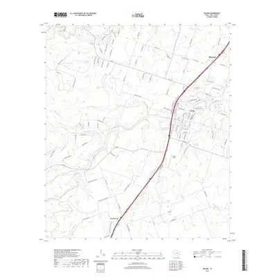
2019 Map of Salado
USGS Topo · Published 2019About this map
Salado and its surrounding Bell County landscape are defined by the winding course of Salado Creek, which draws together numerous tributaries like Buttermilk Cr and Willingham Br. This modern survey illustrates the town's growth alongside Interstate 35, while maintaining traces of its heritage through names like Stinnett Mill Rd, Chisholm Trl, and Amity School Rd. The settlement of Prairie Dell sits further south along the same corridor, punctuated by small ranch lakes and local landmarks such as the Salado Airport.
Find a feature on this map
103 named features on this map. Tap any name to fly to it.
Don’t see what you’re looking for? This feature index may not catch every label — zoom into the map to look around manually.
Map Details
Editions of this 2019 Salado Map
This is the sole edition of this map. No revisions or reprints were ever made.
Other maps of this area

1885 · Taylor
USGS Topo · 1:125,000

1887 · Taylor
USGS Topo · 1:125,000

1892 · Temple
USGS Topo · 1:125,000

1893 · Georgetown
USGS Topo · 1:125,000

1894 · Gatesville
USGS Topo · 1:125,000

1894 · Taylor
USGS Topo · 1:125,000

1924 · Gatesville 4-d
USGS Topo · 1:48,000

1924 · Temple 3-C
USGS Topo · 1:48,000

1930 · Killeen
USGS Topo · 1:62,500

1931 · Belton
USGS Topo · 1:62,500