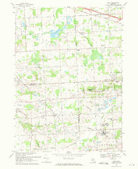
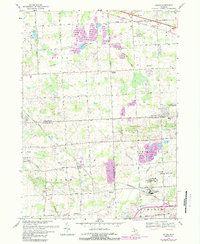
1969 Map of Salem
USGS Topo · Published 1971About this map
The Northville Moraine dominates the local topography of this landscape where the boundaries of Oakland, Wayne, and Washtenaw counties meet. At this time, the area is characterized by a mix of institutional grounds and active extraction sites, most notably the Detroit House of Correction facilities and the sprawling Maybury Sanitarium. Extensive Gravel Pits and a large Gas Storage Field underscore the industrial utility of the terrain during the late 1960s.
Find a feature on this map
58 named features on this map. Tap any name to fly to it.
Don’t see what you’re looking for? This feature index may not catch every label — zoom into the map to look around manually.
Map Details
Editions of this 1969 Salem Map
5 editions found
Other maps of this area

1902 · South Lyon
USGS Topo · 1:62,500

1904 · Ann Arbor
USGS Topo · 1:125,000

1905 · Wayne
USGS Topo · 1:62,500

1906 · South Lyon
USGS Topo · 1:62,500

1907 · Pontiac
USGS Topo · 1:62,500

1908 · Ann Arbor
USGS Topo · 1:125,000

1909 · Milford
USGS Topo · 1:62,500

1912 · Wayne
USGS Topo · 1:62,500

1936 · Wayne
USGS Topo · 1:31,680

1936 · Wixom
USGS Topo · 1:31,680
Featured Places
- Novi, MI
- Northville Charter Township, MI
- Plymouth Charter Township, MI
- Lyon Charter Township, MI
- Wixom, MI