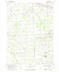
1969 Map of Salem
USGS Topo · Published 1974About this map
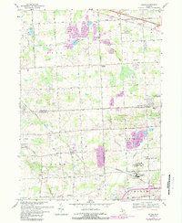
The boundary between Oakland and Washtenaw counties anchors this late 1960s study of a landscape transitioning through suburban development and specialized institutional land use. Major facilities such as the Maybury Sanitarium and the separate men's and women's facilities of the Detroit House of Correction occupy large tracts, reflecting the era's regional infrastructure. These expansive sites sit alongside the emerging residential character of Northville and Novi, while the village of Salem maintains its distinct identity near the Chesapeake and Ohio rail line.
Find a feature on this map
62 named features on this map. Tap any name to fly to it.
Don’t see what you’re looking for? This feature index may not catch every label — zoom into the map to look around manually.
Map Details
Editions of this 1969 Salem Map
5 editions found
Other maps of this area

1902 · South Lyon
USGS Topo · 1:62,500

1904 · Ann Arbor
USGS Topo · 1:125,000

1905 · Wayne
USGS Topo · 1:62,500

1906 · South Lyon
USGS Topo · 1:62,500

1907 · Pontiac
USGS Topo · 1:62,500

1908 · Ann Arbor
USGS Topo · 1:125,000

1909 · Milford
USGS Topo · 1:62,500

1912 · Wayne
USGS Topo · 1:62,500

1936 · Wayne
USGS Topo · 1:31,680

1936 · Wixom
USGS Topo · 1:31,680
Featured Places
- Novi, MI
- Northville Charter Township, MI
- Plymouth Charter Township, MI
- Lyon Charter Township, MI
- Wixom, MI