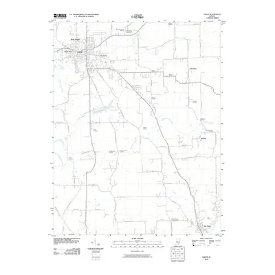
2010 Map of Salem
USGS Topo · Published 2010About this map
Salem anchors this southern Indiana landscape, where the West Fork Blue River and Middle Fork Blue River converge amid a dense network of rural cemeteries and family-named landmarks. The map documents early 21st-century residential developments like Martin Heights and Fair Acres alongside older rural sites such as Blue River Mound and the Poor Farm Cemetery. Transportation corridors like the Martinsburg Rd and S Old 60 connect the town center to surrounding hamlets like Canton, Harristown, and Farabee. Significant local infrastructure is noted, including Lake Salinda and Hardin Airport, providing a detailed record of the area's civil and religious geography. Genealogists will find an exceptional density of burial sites, ranging from the Blue River Hicksite Cemetery to the Tash Cemetery near New Pekin.
Find a feature on this map
71 named features on this map. Tap any name to fly to it.
Don’t see what you’re looking for? This feature index may not catch every label — zoom into the map to look around manually.
Map Details
Editions of this 2010 Salem Map
This is the sole edition of this map. No revisions or reprints were ever made.
Other maps of this area

1941 · Borden
USGS Topo · 1:24,000

1950 · Salem
USGS Topo · 1:24,000

1950 · Becks Mill
USGS Topo · 1:24,000

1950 · Palmyra
USGS Topo · 1:24,000

1951 · Smedley
USGS Topo · 1:24,000

1953 · Fredericksburg
USGS Topo · 1:24,000

1953 · Kossuth
USGS Topo · 1:24,000

1955 · South Boston
USGS Topo · 1:24,000

1956 · Vincennes
USGS Topo · 1:250,000

1956 · Louisville
USGS Topo · 1:250,000