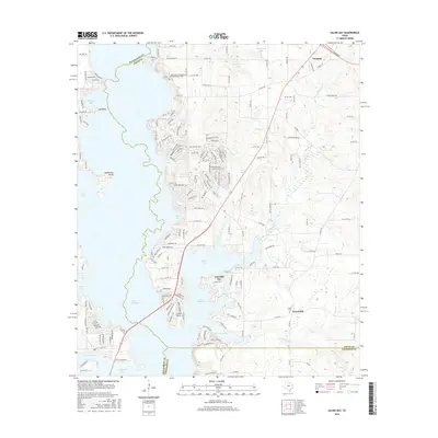
2016 Map of Saline Bay
USGS Topo · Published 2016About this map
Lake Palestine dominates the western half of this 2016 survey, where the waters of the Neches River valley have shaped a complex shoreline of inlets and coves. Residential development is clustered significantly around Emerald Bay and along the eastern finger of the reservoir at Saline Bay, illustrating the transition of this Smith County landscape into a recreational and residential hub. North of these waters, the community of Noonday sits at a crossroads, while the settlement of Teaselville is located further south near the county line.
Find a feature on this map
172 named features on this map. Tap any name to fly to it.
Don’t see what you’re looking for? This feature index may not catch every label — zoom into the map to look around manually.
Map Details
Editions of this 2016 Saline Bay Map
This is the sole edition of this map. No revisions or reprints were ever made.
Other maps of this area

1946 · Bullard
USGS Topo · 1:62,500

1948 · Bullard
USGS Topo · 1:62,500

1948 · Tyler
USGS Topo · 1:62,500

1948 · Brownsboro
USGS Topo · 1:62,500

1949 · Tyler
USGS Topo · 1:62,500

1949 · Brownsboro
USGS Topo · 1:62,500

1949 · Frankston
USGS Topo · 1:62,500

1950 · Frankston
USGS Topo · 1:62,500

1956 · Tyler
USGS Topo · 1:250,000

1966 · Chandler
USGS Topo · 1:24,000