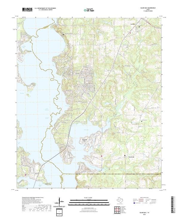
2022 Map of Saline Bay
USGS Topo · Published 2022About this map
Lake Palestine dominates the western landscape of this Smith County region, where the reservoir's complex shoreline creates a series of named inlets like Caney Bay and Highsaw Cove. The residential development along the eastern shore is particularly dense near Coffee City, where local roads such as Bluewater Rd and Co Rd 4217 provide access to the waterfront. Further inland, the terrain is defined by several smaller water bodies, including Tom Clay Lake and Brookshire Lake, which sit north of the established community of Noonday.
Find a feature on this map
184 named features on this map. Tap any name to fly to it.
Don’t see what you’re looking for? This feature index may not catch every label — zoom into the map to look around manually.
Map Details
Editions of this 2022 Saline Bay Map
This is the sole edition of this map. No revisions or reprints were ever made.
Other maps of this area

1946 · Bullard
USGS Topo · 1:62,500

1948 · Bullard
USGS Topo · 1:62,500

1948 · Tyler
USGS Topo · 1:62,500

1948 · Brownsboro
USGS Topo · 1:62,500

1949 · Tyler
USGS Topo · 1:62,500

1949 · Brownsboro
USGS Topo · 1:62,500

1949 · Frankston
USGS Topo · 1:62,500

1950 · Frankston
USGS Topo · 1:62,500

1956 · Tyler
USGS Topo · 1:250,000

1966 · Chandler
USGS Topo · 1:24,000