
1946 Map of Salisbury
USGS Topo · Published 1948About this map
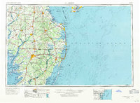
Salisbury serves as the inland hub of this Delmarva Peninsula study, where the Wicomico River meets a network of road and rail. The post-war landscape is defined by its maritime and military presence, from the Fort Miles Military Reservation guarding the entrance to Delaware Bay to the Cape May Naval Air Station at the peninsula's northern tip. Coastal aviation is prominent, evidenced by the Ocean City Seaplane Base tucked behind the barrier islands.
Find a feature on this map
85 named features on this map. Tap any name to fly to it.
Don’t see what you’re looking for? This feature index may not catch every label — zoom into the map to look around manually.
Map Details
Editions of this 1946 Salisbury Map
4 editions found
Other maps of this area

1884 · Sea Isle
USGS Topo · 1:62,500

1888 · Cape May
USGS Topo · 1:62,500

1888 · Dennisville
USGS Topo · 1:62,500

1888 · Sea Isle
USGS Topo · 1:62,500

1890 · Maurice Cove
USGS Topo · 1:62,500

1891 · Maurice Cove
USGS Topo · 1:62,500

1893 · Cape May
USGS Topo · 1:62,500

1894 · Dennisville
USGS Topo · 1:62,500

1894 · Sea Isle
USGS Topo · 1:62,500

1898 · Choptank
USGS Topo · 1:125,000