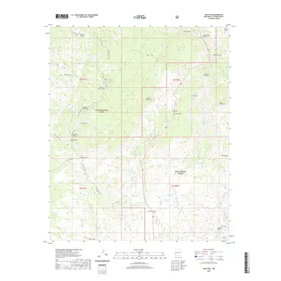
2020 Map of Saliz Pass
USGS Topo · Published 2020About this map
Saliz Pass and the surrounding Saliz Mountains dominate this high-elevation corner of Catron County, where the boundaries of the Apache National Forest and Gila National Forest meet. The landscape is defined by a complex network of canyons and mesas, including the curiously named Gut Ache Mesa and the prominent Chimney Rock. Water sources are critical identifiers in this arid environment, marked by numerous stock tanks like Six Bar Tank and Old Highway Tank, alongside natural features such as Pueblo Park Spring and Pueblo Cr. Traditional backcountry access is documented via the Kelly Camp Trail and Tige Canyon Trail, which navigate through deep cuts like Bang Tail Canyon and Dangerous Park Canyon. This topographic study reveals the intersection of early forest management and the local ranching infrastructure of the early 21st century.
Find a feature on this map
49 named features on this map. Tap any name to fly to it.
Don’t see what you’re looking for? This feature index may not catch every label — zoom into the map to look around manually.
Map Details
Editions of this 2020 Saliz Pass Map
This is the sole edition of this map. No revisions or reprints were ever made.
Other maps of this area

1910 · Mogollon
USGS Topo · 1:125,000

1912 · Mogollon
USGS Topo · 1:125,000

1913 · Morenci
USGS Topo · 1:125,000

1915 · Morenci
USGS Topo · 1:125,000

1915 · Reserve
USGS Topo · 1:125,000

1918 · Reserve
USGS Topo · 1:125,000

1922 · Nutrioso
USGS Topo · 1:125,000

1954 · Clifton
USGS Topo · 1:250,000

1957 · Clifton
USGS Topo · 1:250,000

1958 · Clifton
USGS Topo · 1:250,000