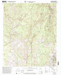
1999 Map of Saliz Pass
USGS Topo · Published 2002About this map
Pueblo Park and a network of canyon-bottom ranching sites characterize this high-elevation landscape in the late 1990s. The terrain is defined by the steep relief of the Saliz Mountains and the Brushy Mountains, where water management was critical for survival and agriculture. A dense distribution of earthen and livestock structures, such as Kelly Tank No. 2, Little Joe Tank, and the WS Corral, reveals how the land was adapted for ranching within the Gila National Forest.
Find a feature on this map
60 named features on this map. Tap any name to fly to it.
Don’t see what you’re looking for? This feature index may not catch every label — zoom into the map to look around manually.
Map Details
Editions of this 1999 Saliz Pass Map
This is the sole edition of this map. No revisions or reprints were ever made.
Other maps of this area

1910 · Mogollon
USGS Topo · 1:125,000

1912 · Mogollon
USGS Topo · 1:125,000

1913 · Morenci
USGS Topo · 1:125,000

1915 · Morenci
USGS Topo · 1:125,000

1915 · Reserve
USGS Topo · 1:125,000

1918 · Reserve
USGS Topo · 1:125,000

1922 · Nutrioso
USGS Topo · 1:125,000

1954 · Clifton
USGS Topo · 1:250,000

1957 · Clifton
USGS Topo · 1:250,000

1958 · Clifton
USGS Topo · 1:250,000