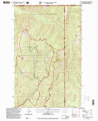
1996 Map of Salmo Mountain
USGS Topo · Published 1999About this map
Salmo Mountain and the surrounding high ridges of the Selkirk Range dominate this 1990s forest survey at the intersection of Washington, Idaho, and British Columbia. The landscape is defined by the protected status of the Salmo - Priest Wilderness, which spans the Colville National Forest and Kaniksu National Forest. Topographic details reveal a network of high-elevation peaks, including Shedroof Mountain and Leola Peak, where a Lookout station is noted at the summit of Salmo Mountain.
Find a feature on this map
31 named features on this map. Tap any name to fly to it.
Don’t see what you’re looking for? This feature index may not catch every label — zoom into the map to look around manually.
Map Details
Editions of this 1996 Salmo Mountain Map
This is the sole edition of this map. No revisions or reprints were ever made.
Other maps of this area

1911 · Priest Lake
USGS Topo · 1:250,000

1913 · Priest Lake
USGS Topo · 1:250,000

1934 · Metaline
USGS Topo · 1:125,000

1942 · Metaline
USGS Topo · 1:125,000

1958 · Sandpoint
USGS Topo · 1:250,000

1963 · Sandpoint
USGS Topo · 1:250,000

1967 · Gypsy Peak
USGS Topo · 1:24,000

1967 · Salmo Mtn.
USGS Topo · 1:24,000

1967 · Helmer Mtn
USGS Topo · 1:24,000

1967 · Pass Creek
USGS Topo · 1:24,000