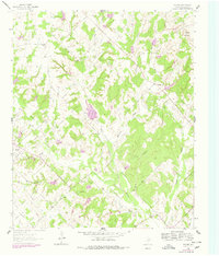
1961 Map of Salona
USGS Topo · Published 1978About this map
Salona and the surrounding ranching and petroleum lands of Montague County are revealed in this 1961 survey, which includes purple photorevisions from 1976. The landscape is defined by the drainage basins of Denton Creek and Dry Valley Creek, where numerous small tributaries like Stillhouse Creek and Caddo Creek carve through the terrain. The presence of the Mueller Oil Field and Mallard Oil Field highlights the industrial character of the region during the mid-20th century, with scattered oil wells dotting the valleys.
Find a feature on this map
25 named features on this map. Tap any name to fly to it.
Don’t see what you’re looking for? This feature index may not catch every label — zoom into the map to look around manually.
Map Details
Editions of this 1961 Salona Map
2 editions found
Other maps of this area

1905 · Montague
USGS Topo · 1:125,000

1954 · Sherman
USGS Topo · 1:250,000

1958 · Sherman
USGS Topo · 1:250,000

1960 · Buzzard Roost Knob
USGS Topo · 1:24,000

1961 · Saint Jo
USGS Topo · 1:24,000

1961 · Salona
USGS Topo · 1:24,000

1961 · New Harp
USGS Topo · 1:24,000

1961 · Montague
USGS Topo · 1:24,000

1961 · Sunset
USGS Topo · 1:24,000
1961 · Smyrna
USGS Topo · 1:24,000