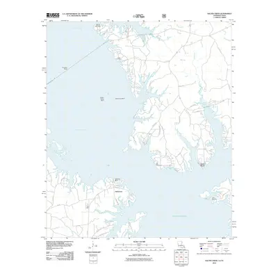
2010 Map of Salter Creek
USGS Topo · Published 2010About this map
Toledo Bend Reservoir dominates this landscape along the Louisiana-Texas border, where the flooded basin of the Sabine River creates a complex network of points, bluffs, and inlets. On the southern banks near the water's edge lies Sabinetown, a site with deep ties to the river's navigational history. The geography is defined by prominent elevations such as Merritt Mountain and the distinct river overlooks of Stone Coal Bluff and Goodlow Bluff.
Find a feature on this map
46 named features on this map. Tap any name to fly to it.
Don’t see what you’re looking for? This feature index may not catch every label — zoom into the map to look around manually.
Map Details
Editions of this 2010 Salter Creek Map
This is the sole edition of this map. No revisions or reprints were ever made.
Other maps of this area

1941 · Zwolle
USGS Topo · 1:62,500

1944 · Negreet
USGS Topo · 1:62,500

1944 · Patroon
USGS Topo · 1:62,500

1944 · Zwolle
USGS Topo · 1:62,500

1953 · Alexandria
USGS Topo · 1:250,000

1954 · Toro
USGS Topo · 1:24,000

1954 · Columbus
USGS Topo · 1:24,000
1954 · Negreet
USGS Topo · 1:24,000

1954 · Negreet
USGS Topo · 1:62,500

1954 · Salter Creek
USGS Topo · 1:24,000