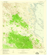
1956 Map of Saltillo Ranch
USGS Topo · Published 1959About this map
Saltillo Ranch and the Norias Headquarters King Ranch anchor this mid-century survey of the South Texas brush country. The landscape is defined by the transition from coastal waters to inland ranching operations, where life and industry depend entirely on subsurface water sources. A dense network of infrastructure including the Huisache Artesian Well, Salvador Windmill, and Conchas Wells supports livestock across the shifting terrain. To the east, the shallow waters of the Laguna Madre meet the shore at the Rincon Mesquite, dotted with features like the Calabazas Islands and the Tres Marias banks. The map records a self-contained ranching community, complete with the Norias School and a private Airstrip, illustrating the scale and isolation of these historic Texas holdings before modern development altered the remote coastal plains.
Find a feature on this map
37 named features on this map. Tap any name to fly to it.
Don’t see what you’re looking for? This feature index may not catch every label — zoom into the map to look around manually.
Map Details
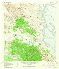
Editions of this 1956 Saltillo Ranch Map
2 editions found
Other maps of this area

1921 · Tarida Ranch
USGS Topo · 1:62,500

1922 · La Sal Vieja
USGS Topo · 1:62,500

1923 · Armstrong
USGS Topo · 1:62,500

1923 · Lopena Island
USGS Topo · 1:62,500

1923 · Saltillo Ranch
USGS Topo · 1:62,500

1928 · Sarita
USGS Topo · 1:125,000

1950 · Corpus Christi
USGS Topo · 1:250,000

1951 · Potrero Lopeno NW
USGS Topo · 1:24,000

1952 · Potrero Cortado
USGS Topo · 1:24,000

1952 · South of Potrero Lopeno NW
USGS Topo · 1:24,000