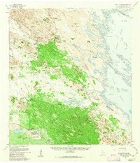
1956 Map of Saltillo Ranch
USGS Topo · Published 1963About this map
The Norias Headquarters King Ranch anchor this mid-century survey of the Kenedy County coastline, revealing the infrastructure of a massive South Texas cattle operation. The map details a landscape where survival depends on a sprawling network of water sources, from the Agua Dulce Artesian Well to the Chicago Windmill. Settlement is centered on working ranch hubs like San Pedro Ranch and the Saltillo Ranch (Site), with local life represented by the Norias School and a private Airstrip. Eastward, the terrain gives way to the vast Laguna Madre, defined by Shifting Sand Dunes and tidal flats. Notable landmarks such as Cayo Soledad and the Calabazas Islands mark the edge of the mainland, where the fence lines of the King Ranch meet the mud and sand of the Laguna coast.
Find a feature on this map
63 named features on this map. Tap any name to fly to it.
Don’t see what you’re looking for? This feature index may not catch every label — zoom into the map to look around manually.
Map Details
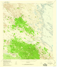
Editions of this 1956 Saltillo Ranch Map
2 editions found
Other maps of this area

1921 · Tarida Ranch
USGS Topo · 1:62,500

1922 · La Sal Vieja
USGS Topo · 1:62,500

1923 · Armstrong
USGS Topo · 1:62,500

1923 · Lopena Island
USGS Topo · 1:62,500

1923 · Saltillo Ranch
USGS Topo · 1:62,500

1928 · Sarita
USGS Topo · 1:125,000

1950 · Corpus Christi
USGS Topo · 1:250,000

1951 · Potrero Lopeno NW
USGS Topo · 1:24,000

1952 · Potrero Cortado
USGS Topo · 1:24,000

1952 · South of Potrero Lopeno NW
USGS Topo · 1:24,000