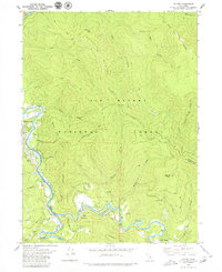
1979 Map of Salyer
USGS Topo · Published 1979About this map
The Trinity River winds through the heart of this landscape, marking the rugged boundary between Humboldt and Trinity counties. In the late 1970s, this area reflects a mix of small mountain settlements and the vast reach of the Six Rivers National Forest. Local activity is clustered near Willow Creek and China Flat, where a Drive-in Theater once served the community. To the southeast, the South Fork Trinity River joins the main branch near Salyer, a hub of local transport and forest management evidenced by the Work Center. High ridges like Waterman Ridge and Hennessy Ridge define the steep topography, while family and place-name landmarks like Sandy Bar and Hawkins Creek indicate established riverside sites. The map also documents small pockets of development like Trinity Village, showing how human settlement followed the river benches amidst the steep, timbered terrain.
Find a feature on this map
45 named features on this map. Tap any name to fly to it.
Don’t see what you’re looking for? This feature index may not catch every label — zoom into the map to look around manually.
Map Details
Editions of this 1979 Salyer Map
2 editions found
Other maps of this area

1909 · Big Bar
USGS Topo · 1:96,000

1915 · Big Bar and Vicinity
USGS Topo · 1:250,000

1922 · China Flat
USGS Topo · 1:62,500

1925 · Hoopa
USGS Topo · 1:125,000

1948 · Weed
USGS Topo · 1:250,000

1950 · Weed
USGS Topo · 1:250,000

1951 · Ironside Mountain
USGS Topo · 1:62,500

1952 · Willow Creek
USGS Topo · 1:62,500

1952 · Hoopa
USGS Topo · 1:62,500

1955 · Salmon Mtn
USGS Topo · 1:62,500