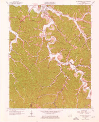
1962 Map of Salyersville South
USGS Topo · Published 1976About this map
The Licking River winds through the heart of this Magoffin County landscape, anchoring a network of small valley communities and family settlements. By the early 1960s, the region's transport identity was defined by the Chesapeake and Ohio railroad and the Parkway Toll Road, which intersect the traditional agrarian patterns of the river bottoms. Local life is recorded through numerous family landmarks, including the Caudill Cem, Gardner Cem, and the Mouth of Rockhouse Ch.
Find a feature on this map
70 named features on this map. Tap any name to fly to it.
Don’t see what you’re looking for? This feature index may not catch every label — zoom into the map to look around manually.
Map Details
Editions of this 1962 Salyersville South Map
3 editions found
Other maps of this area

1886 · Prestonsburg
USGS Topo · 1:125,000

1889 · Salyersville
USGS Topo · 1:125,000

1891 · Salyersville
USGS Topo · 1:125,000

1892 · Prestonsburg
USGS Topo · 1:125,000

1899 · Salyersville
USGS Topo · 1:125,000

1915 · Paintsville
USGS Topo · 1:48,000

1915 · Prestonsburg
USGS Topo · 1:62,500

1917 · Paintsville
USGS Topo · 1:62,500

1918 · Prestonsburg
USGS Topo · 1:62,500

1951 · Tiptop
USGS Topo · 1:24,000