1946 Map of Sam Knob
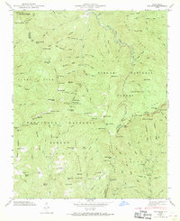
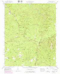
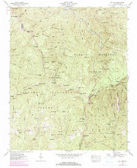
USGS Topo · Published 1977About this map
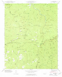
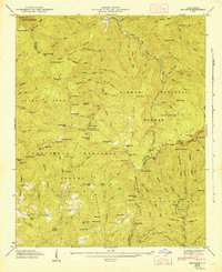
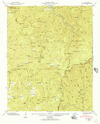
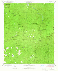
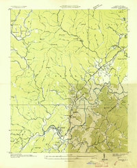
Pisgah National Forest and Nantahala National Forest meet at a high-elevation divide where the Blue Ridge Parkway traces the crest of the Balsam Mountains. This 1946 field examination by the Tennessee Valley Authority highlights a landscape defined by sharp ridges and deep water gaps, including Richland Gap and Beartrail Ridge Gap. Significant peaks like Richland Balsam and Sam Knob tower over the headwaters of the West Fork Pigeon River. The map documents numerous remote landmarks such as Courthouse Falls and Dill Falls, alongside established mountain markers like Charley Bald and Gage Bald. The terrain is characterized by a dense network of prongs and branches, including the Turnpike Cr and Yellow Creek, showing the complex drainage patterns before extensive modern development altered the wilderness character of the Haywood and Transylvania county lines.
Find a feature on this map
115 named features on this map. Tap any name to fly to it.
Don’t see what you’re looking for? This feature index may not catch every label — zoom into the map to look around manually.
Map Details
Editions of this 1946 Sam Knob Map
7 editions found
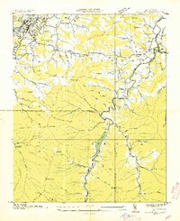
Other maps of this area

1891 · Cowee
USGS Topo · 1:125,000

1897 · Cowee
USGS Topo · 1:125,000

1905 · Pisgah
USGS Topo · 1:125,000

1906 · Pisgah
USGS Topo · 1:125,000

1907 · Cowee
USGS Topo · 1:125,000

1935 · Cruso
USGS Topo · 1:24,000
1935 · Waynesville
USGS Topo · 1:24,000

1935 · Sam Knob
USGS Topo · 1:24,000
1935 · Rosman
USGS Topo · 1:24,000

1935 · Tuckaseigee
USGS Topo · 1:24,000