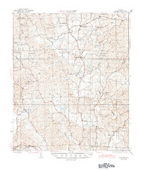
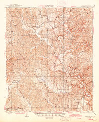
1928 Map of Samantha
USGS Topo · Published 1945About this map
North River and its meandering tributaries, such as Binion Creek and Cripple Creek, define the landscape of northern Tuscaloosa County during the mid-1920s. This agricultural and rural industrial corridor was anchored by small commercial centers like Samantha and Bell City, along with numerous family-owned outposts including Longs Store and Barnetts Store. The network of early roads, including the Sipsey Road and Byler Road, connected these upland communities to the Mobile and Ohio Railroad in the southwest near Buhl.
Find a feature on this map
75 named features on this map. Tap any name to fly to it.
Don’t see what you’re looking for? This feature index may not catch every label — zoom into the map to look around manually.
Map Details
Editions of this 1928 Samantha Map
6 editions found
Other maps of this area

1893 · Jasper
USGS Topo · 1:125,000

1899 · Brookwood
USGS Topo · 1:125,000

1924 · Tuscaloosa
USGS Topo · 1:62,500

1926 · Samantha
USGS Topo · 1:48,000

1926 · Tuscaloosa
USGS Topo · 1:62,500

1928 · Samantha
USGS Topo · 1:62,500

1929 · Searles
USGS Topo · 1:48,000

1931 · Cottondale
USGS Topo · 1:48,000

1934 · Searles
USGS Topo · 1:62,500

1934 · Cottondale
USGS Topo · 1:62,500