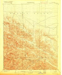
1903 Map of San Antonio
USGS Topo · Published 1916About this map
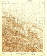
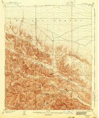
The San Antonio Mountains dominate this early 20th-century landscape, showing the sharp transition from the Mohave Desert to the high elevations of the Angelles National Forest. This era predates modern infrastructure, focusing on the topographic relief of the eastern San Gabriel range. Prominent peaks such as San Antonio Peak (Baldy) and Telegraph Peak are mapped alongside the treacherous Devils Backbone. The drainage patterns of Lytle Creek and the Prairie Fork reveal the deep canyons and narrow passes that defined early transit through the region. At The Narrows and along Lone Pine Canyon, the map captures the geological severity of the area before extensive development. Remote drainage points like Mine Gulch and Vincent Gulch hint at the prospecting and early resource exploration that drew settlers into these steep, water-carved ravines.
Find a feature on this map
37 named features on this map. Tap any name to fly to it.
Don’t see what you’re looking for? This feature index may not catch every label — zoom into the map to look around manually.
Map Details
Editions of this 1903 San Antonio Map
7 editions found

Other maps of this area

1894 · Pomona
USGS Topo · 1:62,500

1896 · San Bernardino
USGS Topo · 1:62,500

1897 · Pomona
USGS Topo · 1:62,500

1897 · Cucamonga
USGS Topo · 1:62,500

1898 · Pomona
USGS Topo · 1:62,500

1898 · San Bernardino
USGS Topo · 1:62,500

1900 · Cucamonga
USGS Topo · 1:62,500

1901 · Southern California Sheet No. 1
USGS Topo · 1:250,000

1901 · San Bernardino
USGS Topo · 1:62,500

1902 · Hesperia
USGS Topo · 1:62,500