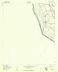
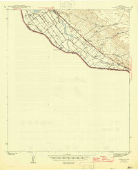
1955 Map of San Elizario
USGS Topo · Published 1959About this map
San Elizario serves as the focal point of this 1950s borderland survey, situated along the complex irrigation and drainage networks of the El Paso Valley. The landscape is defined by the proximity of the Rio Grande, which forms the international boundary between Texas and Mexico. Agriculture and transit dictate the town's layout, with numerous named waterways such as the Riverside Canal and San Elizario Lateral crisscrossing the terrain to support local farming.
Find a feature on this map
30 named features on this map. Tap any name to fly to it.
Don’t see what you’re looking for? This feature index may not catch every label — zoom into the map to look around manually.
Map Details
Editions of this 1955 San Elizario Map
4 editions found

Other maps of this area

1896 · El Paso
USGS Topo · 1:125,000

1896 · Rio Grande
USGS Topo · 1:125,000

1908 · El Paso
USGS Topo · 1:125,000

1939 · Ysleta
USGS Topo · 1:62,500

1941 · Clint
USGS Topo · 1:62,500

1941 · Ysleta
USGS Topo · 1:62,500

1941 · Tornillo
USGS Topo · 1:62,500

1945 · Ysleta
USGS Topo · 1:62,500
1945 · Clint
USGS Topo · 1:62,500
1945 · Tornillo
USGS Topo · 1:62,500