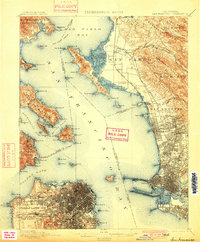
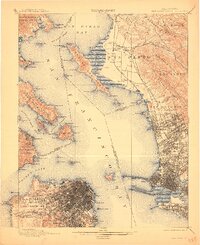
1899 Map of San Francisco
USGS Topo · Published 1900About this map
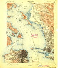
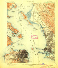
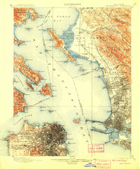
The University of California overlooks a growing East Bay corridor where the California And Nevada R. R. and Southern Pacific R. R. converge toward the shoreline. This 1890s survey documents the intricate street grids of Oakland and Berkeley alongside the industrial waterfronts of Emery and Stege. To the west, the Presidio and Military Reservation dominate the tip of the peninsula, guarding the Golden Gate while the city of San Francisco expands southward through the Pueblo Lands of San Francisco and Potrero Nuevo. Notable landmarks of the era include the Cliff House on the Pacific coast and the U. S. Marine Hospital near Mountain Lake. The map captures a critical period of connectivity, showing the Oakland Mole extending into the San Francisco Bay to meet the ferry traffic, and the Deep Water Channel guiding vessels toward the San Antonio Creek wharves before the modern harbor was fully realized.
Find a feature on this map
115 named features on this map. Tap any name to fly to it.
Don’t see what you’re looking for? This feature index may not catch every label — zoom into the map to look around manually.
Map Details
Editions of this 1899 San Francisco Map
7 editions found

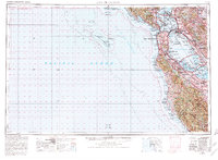
Historical Maps of San Francisco Through Time
14 maps found

1895 San Francisco
San Francisco County, CA

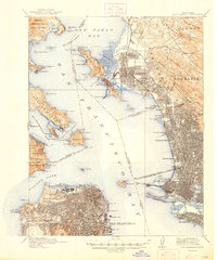
1899 San Francisco
San Francisco County, CA
1915 San Francisco
San Francisco County, CA

1947 San Francisco
San Francisco County, CA

1948 San Francisco
San Francisco County, CA

1955 San Francisco
San Francisco County, CA
1956 San Francisco
San Francisco County, CA

1957 San Francisco
San Francisco County, CA

1960 San Francisco
San Francisco County, CA

1961 San Francisco
San Francisco County, CA

1964 San Francisco
San Francisco County, CA

1971 San Francisco
San Francisco County, CA

1978 San Francisco
San Francisco County, CA

1985 San Francisco
San Francisco County, CA