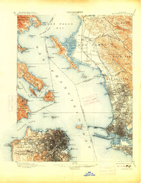
1899 Map of San Francisco
USGS Topo · Published 1914About this map
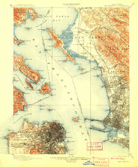
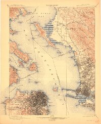
The Pueblo Lands of San Francisco are depicted in striking detail at the close of the nineteenth century, showing a city defined by its dense street grid and emerging civic spaces like Golden Gate Park. Along the northern waterfront, the military presence is prominent at the Presidio and Fort Mason, while the legendary Cliff House stands on the western edge overlooking the Pacific. Across the Golden Gate, the settlements of Sausalito and Tiburon are connected by the N. P. Coast R. R., marking the early transportation hubs of the North Bay.
Find a feature on this map
125 named features on this map. Tap any name to fly to it.
Don’t see what you’re looking for? This feature index may not catch every label — zoom into the map to look around manually.
Map Details
Editions of this 1899 San Francisco Map
7 editions found
Other maps of this area

1892 · San Mateo
USGS Topo · 1:62,500

1895 · San Francisco
USGS Topo · 1:62,500

1896 · San Mateo
USGS Topo · 1:62,500

1896 · Carquinez Strait
USGS Topo · 1:62,500

1897 · Concord
USGS Topo · 1:62,500

1897 · Tamalpais
USGS Topo · 1:62,500

1898 · Karquines
USGS Topo · 1:62,500

1899 · San Francisco
USGS Topo · 1:62,500

1899 · Haywards
USGS Topo · 1:62,500

1899 · San Mateo
USGS Topo · 1:62,500