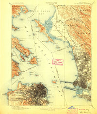
1899 Map of San Francisco
USGS Topo · Published 1906About this map
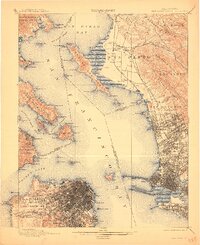
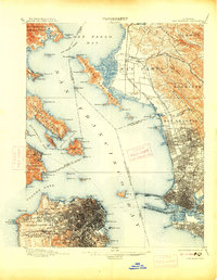
San Francisco Bay serves as the central focal point of this late-nineteenth-century survey, illustrating the dense urban development of San Francisco and the growing coastal hubs of Oakland and Berkeley. The map documents a critical period of infrastructure, showing the Oakland Mole extending into the bay and the intricate rail networks of the Southern Pacific R. R. and the California and Nevada R. R. connecting shoreline communities. Beyond the city grids, significant landmarks like the Presidio and Golden Gate Park are clearly defined alongside industrial and maritime features like the U. S. Marine Hospital and Shell Mound. This era was defined by the transition from ranchos to incorporated cities, seen in the labeling of the San Antonio (V. & D. Peralta) boundary and the nascent campus of the University of California.
Find a feature on this map
124 named features on this map. Tap any name to fly to it.
Don’t see what you’re looking for? This feature index may not catch every label — zoom into the map to look around manually.
Map Details
Editions of this 1899 San Francisco Map
7 editions found
Other maps of this area

1892 · San Mateo
USGS Topo · 1:62,500

1895 · San Francisco
USGS Topo · 1:62,500

1896 · San Mateo
USGS Topo · 1:62,500

1896 · Carquinez Strait
USGS Topo · 1:62,500

1897 · Concord
USGS Topo · 1:62,500

1897 · Tamalpais
USGS Topo · 1:62,500

1898 · Karquines
USGS Topo · 1:62,500

1899 · San Francisco
USGS Topo · 1:62,500

1899 · Haywards
USGS Topo · 1:62,500

1899 · San Mateo
USGS Topo · 1:62,500