1956 Map of San Francisco South
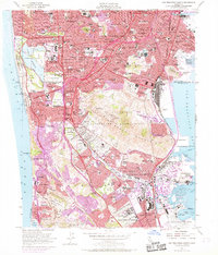
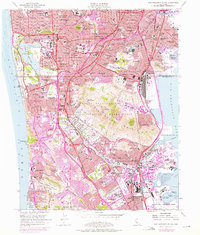
USGS Topo · Published 1981About this map
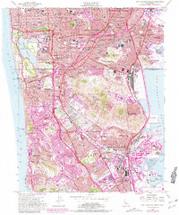
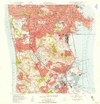
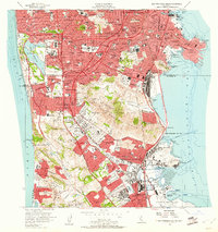
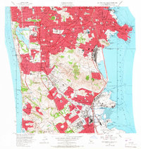
The northern reaches of San Mateo County and the southern edge of San Francisco showcase a densely packed landscape of postwar development and specialized land use in the mid-1950s. Colma serves as a distinct necropolis, featuring an extraordinary concentration of burial grounds including Holy Cross Cemetery, Hills of Eternity Memorial Park, and Cypress Lawn Memorial Park. This pattern of suburban growth is further defined by extensive educational and recreation sites, from San Francisco State College near Lake Merced to the numerous golf courses such as the Olympic Golf Club and San Francisco Golf Club.
Find a feature on this map
118 named features on this map. Tap any name to fly to it.
Don’t see what you’re looking for? This feature index may not catch every label — zoom into the map to look around manually.
Map Details
Editions of this 1956 San Francisco South Map
6 editions found
Other maps of this area

1892 · San Mateo
USGS Topo · 1:62,500

1895 · San Francisco
USGS Topo · 1:62,500

1896 · San Mateo
USGS Topo · 1:62,500

1897 · Tamalpais
USGS Topo · 1:62,500

1899 · San Francisco
USGS Topo · 1:62,500

1899 · San Mateo
USGS Topo · 1:62,500

1915 · San Mateo
USGS Topo · 1:62,500

1915 · San Francisco
USGS Topo · 1:62,500

1939 · San Mateo
USGS Topo · 1:62,500

1941 · Tamalpais
USGS Topo · 1:62,500