1950 Map of San German NE
USGS Topo · Published 1950About this map
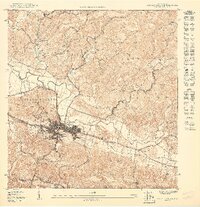
San German stands at the center of this detailed 1950 topographical study, revealing the urban core divided into Pueblo Oriental, Pueblo Central, and Pueblo Occidental. The town’s social and infrastructure landscape is anchored by the Instituto Politecnico and the Cementerio de Germán, while the American RR line traces a path through the southern valley floor. The terrain transitions from the alluvial plains of the Río Guanajibo to the prominent heights of Cerro El Retiro and the ridges of Cain Alto. Numerous named streams, including Río Caín and Quebrada Rodeo, drain the northern highlands, reflecting a landscape where water and topography dictated early settlement patterns and barrio boundaries like Sabana Grande Abajo and Hoconuco Alto.
Find a feature on this map
31 named features on this map. Tap any name to fly to it.
Don’t see what you’re looking for? This feature index may not catch every label — zoom into the map to look around manually.
Map Details
Editions of this 1950 San German NE Map
This is the sole edition of this map. No revisions or reprints were ever made.
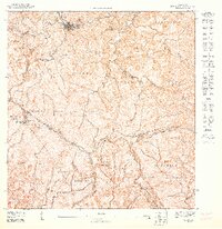
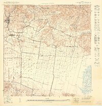
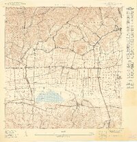
Other maps of this area

1937 · San German
USGS Topo · 1:25,000

1937 · Sabana Grande
USGS Topo · 1:25,000

1941 · San German
USGS Topo · 1:30,000

1941 · Sabana Grande
USGS Topo · 1:30,000

1941 · Rosario
USGS Topo · 1:30,000

1942 · Rosario
USGS Topo · 1:30,000

1946 · Maricao
USGS Topo · 1:30,000
1947 · Maricao SO
USGS Topo · 1:10,000
1949 · San German SE
USGS Topo · 1:10,000
1949 · San German SO
USGS Topo · 1:10,000
Featured Places
- San Germán, San Germán
- Sector La Panchita, San Germán
- Sector Los Guilardo, San Germán
- Palo Solo, San Germán
- San Germán