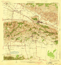
1941 Map of San German
USGS Topo · Published 1941About this map
The San German urban center and the fertile Valle de Lajas define this mid-1930s landscape of southwestern Puerto Rico. This era is marked by the industrial presence of Central Eureka and a dense network of family estates, including Hacienda Beatriz Soledad and Hacienda Resolucion. The American Railroad of Porto Rico serves as the primary artery for the sugarcane economy, connecting the town to rural outposts like Estacion Lajas and the Desvio Grant siding.
Find a feature on this map
70 named features on this map. Tap any name to fly to it.
Don’t see what you’re looking for? This feature index may not catch every label — zoom into the map to look around manually.
Map Details
Editions of this 1941 San German Map
5 editions found
Other maps of this area

1935 · Puerto Real
USGS Topo · 1:25,000

1937 · San German
USGS Topo · 1:25,000

1937 · Sabana Grande
USGS Topo · 1:25,000

1937 · Puerto Real
USGS Topo · 1:25,000

1938 · Guanica
USGS Topo · 1:30,000

1938 · Parguera
USGS Topo · 1:30,000

1938 · Cabo Rojo
USGS Topo · 1:30,000

1939 · Mayaguez
USGS Topo · 1:30,000

1941 · San German
USGS Topo · 1:30,000

1941 · Puerto Real
USGS Topo · 1:30,000