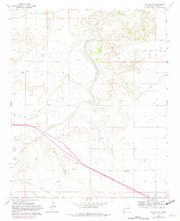
1968 Map of San Jon
USGS Topo · Published 1982About this map
Revuelto Creek and its seasonal tributaries carve a distinct drainage pattern through this high plains landscape of Quay County. This 1968 photogrammetric survey, updated with revisions in the early 1980s, reveals an agricultural environment defined by water management and ranching. The presence of the Hudson Canal along with the Conchas Lateral, Sours Lateral, and Mc Caskey Lateral irrigation features demonstrates the engineered efforts to sustain life in this arid region.
Find a feature on this map
15 named features on this map. Tap any name to fly to it.
Don’t see what you’re looking for? This feature index may not catch every label — zoom into the map to look around manually.
Map Details
Editions of this 1968 San Jon Map
3 editions found
Other maps of this area

1954 · Tucumcari
USGS Topo · 1:250,000

1954 · Clovis
USGS Topo · 1:250,000

1958 · Clovis
USGS Topo · 1:250,000

1958 · Tucumcari
USGS Topo · 1:250,000

1968 · Porter
USGS Topo · 1:24,000

1968 · Riley Camp
USGS Topo · 1:24,000

1968 · San Jon
USGS Topo · 1:24,000

1968 · Bard
USGS Topo · 1:24,000

1968 · San Jon NW
USGS Topo · 1:24,000

1968 · Bedford Hill
USGS Topo · 1:24,000