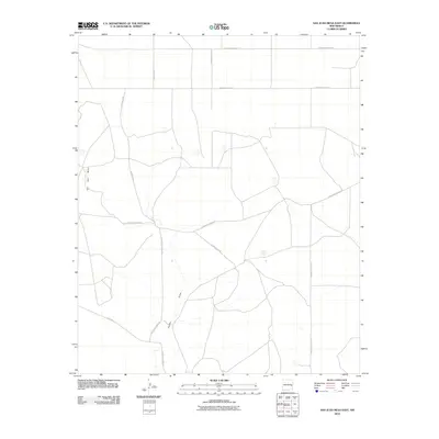
2010 Map of San Juan Mesa East
USGS Topo · Published 2010About this map
The San Juan Mesa escarpment dominates the western edge of this Chaves County landscape, providing a sharp topographical contrast to the expansive plains of eastern New Mexico. This 2010 survey illustrates the organized grid of the Roosevelt County line area, where a network of thoroughfares like S Roosevelt Road 18 and S Roosevelt Road 19 service the agricultural and ranching operations characteristic of the High Plains. Drainage patterns are defined by the intermittent Falsey Draw, which meanders through the central and southern portions of the quadrangle. The map reveals the local infrastructure of the era, including the Boone Ranch Rd and several family-named or numbered routes such as S Roosevelt Road Ave and Olive Rd, documenting the rural land use and access points vital to the region's economy.
Find a feature on this map
12 named features on this map. Tap any name to fly to it.
Don’t see what you’re looking for? This feature index may not catch every label — zoom into the map to look around manually.
Map Details
Editions of this 2010 San Juan Mesa East Map
This is the sole edition of this map. No revisions or reprints were ever made.
Other maps of this area

1954 · Clovis
USGS Topo · 1:250,000

1954 · Brownfield
USGS Topo · 1:250,000

1958 · Brownfield
USGS Topo · 1:250,000

1958 · Clovis
USGS Topo · 1:250,000

1962 · Brownfield
USGS Topo · 1:250,000

1973 · Lewiston Lake
USGS Topo · 1:24,000

1973 · Gammil Well SE
USGS Topo · 1:24,000
1973 · Rippee Ranch
USGS Topo · 1:24,000
1978 · Elida
USGS Topo · 1:24,000

1979 · Kenna
USGS Topo · 1:24,000