
1925 Map of San Marcos 1-d
USGS Topo · Published 1925About this map
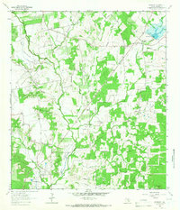
Mc Mahan and Tilmon anchor this rural landscape in eastern Caldwell County during the mid-1920s, a period when local life revolved around a dense network of country schools and churches. The drainage of Plum Creek and its various tributaries, including Sixmile Branch and Clear Fork Plum Creek, dictates the placement of settlements and farms. This sheet is particularly notable for its high density of educational and spiritual landmarks, such as the Lovely Plant School, Harmony Grove School, and Clark Chapel, which served the farming families of the era.
Find a feature on this map
29 named features on this map. Tap any name to fly to it.
Don’t see what you’re looking for? This feature index may not catch every label — zoom into the map to look around manually.
Map Details
Editions of this 1925 San Marcos 1-d Map
This is the sole edition of this map. No revisions or reprints were ever made.
Other maps of this area

1901 · Flatonia
USGS Topo · 1:125,000

1911 · San Marcos
USGS Topo · 1:125,000

1919 · San Marcos
USGS Topo · 1:125,000

1925 · San Marcos 4-a
USGS Topo · 1:48,000

1929 · Luling
USGS Topo · 1:62,500

1930 · Lockhart
USGS Topo · 1:62,500

1953 · Seguin
USGS Topo · 1:250,000

1958 · Seguin
USGS Topo · 1:250,000

1963 · Lockhart North
USGS Topo · 1:24,000
1963 · McMahan
USGS Topo · 1:24,000