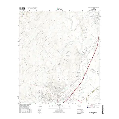
2016 Map of San Marcos North
USGS Topo · Published 2016About this map
The Blanco River and San Marcos River converge in this transition between the Texas Hill Country and the blackland prairies during the mid-2010s. The landscape is anchored by the presence of Texas State Univ San Marcos and the natural hydrology of San Marcos Springs and Spring Lake. While the city of San Marcos dominates the southern portion of the sheet, the northern corridor shows the steady growth of Kyle along the interstate. Local history is preserved in several burial grounds, including the San Marcos Community Cem and the Kyle Cem. The western terrain is marked by numerous rural routes like Co Rd 387 and Co Rd 222, while the east opens toward the San Marcos Municipal Airport near the border of Hays and Caldwell counties.
Find a feature on this map
169 named features on this map. Tap any name to fly to it.
Don’t see what you’re looking for? This feature index may not catch every label — zoom into the map to look around manually.
Map Details
Editions of this 2016 San Marcos North Map
This is the sole edition of this map. No revisions or reprints were ever made.
Other maps of this area

1887 · Blanco
USGS Topo · 1:125,000

1894 · Blanco
USGS Topo · 1:125,000

1896 · Austin
USGS Topo · 1:125,000

1897 · Austin
USGS Topo · 1:125,000

1910 · Austin
USGS Topo · 1:125,000

1911 · San Marcos
USGS Topo · 1:125,000

1919 · San Marcos
USGS Topo · 1:125,000

1929 · Hunter
USGS Topo · 1:62,500

1953 · Seguin
USGS Topo · 1:250,000

1954 · Llano
USGS Topo · 1:250,000