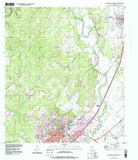
1995 Map of San Marcos North
USGS Topo · Published 1998About this map
The Blanco River snakes through this Central Texas landscape, defining the corridor between the expanding communities of San Marcos and Kyle. The transition from the Edwards Plateau into the Blackland Prairie is visible in the network of spring-fed waters, most notably where Sink Creek feeds into Spring Lake. The map details a community deeply rooted in its local institutions, from the San Marcos Baptist Academy to the historic San Vincente Cem and Kyle Cem. Infrastructure like the San Marcos Municipal Airport and numerous Gravel Pits along the riverbanks suggest the region's mid-century industrial and transportation development. The grid of downtown San Marcos, centered around the Courthouse and streets like Hopkins St, contrasts with the winding canyon of Purgatory Creek to the west.
Find a feature on this map
28 named features on this map. Tap any name to fly to it.
Don’t see what you’re looking for? This feature index may not catch every label — zoom into the map to look around manually.
Map Details
Editions of this 1995 San Marcos North Map
This is the sole edition of this map. No revisions or reprints were ever made.
Other maps of this area

1887 · Blanco
USGS Topo · 1:125,000

1894 · Blanco
USGS Topo · 1:125,000

1896 · Austin
USGS Topo · 1:125,000

1897 · Austin
USGS Topo · 1:125,000

1910 · Austin
USGS Topo · 1:125,000

1911 · San Marcos
USGS Topo · 1:125,000

1919 · San Marcos
USGS Topo · 1:125,000

1929 · Hunter
USGS Topo · 1:62,500

1953 · Seguin
USGS Topo · 1:250,000

1954 · Llano
USGS Topo · 1:250,000