
1956 Map of San Perlita North
USGS Topo · Published 1958About this map
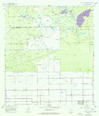
The Punta del Monte Ranch and its adjacent Cem define the northern reaches of this South Texas landscape, where the Kenedy Co Willacy Co line runs through a region increasingly shaped by hydraulic engineering. Below the Approximate Boundary, the land is marked by an extensive network of windmills used for ranching and early petroleum extraction, including the Las Golondrinas Windmill and numerous Oil Tanks. The southern portion of the quadrangle reveals a significant shift toward organized irrigation and transportation near the edge of San Perlita. The Old Railroad Grade and a series of drainage features like the East Main Drain and Spoil Bank illustrate the mid-century effort to reclaim and manage these coastal plains. Artesian wells such as the Villarreal Artesian Well provide essential water sources in a terrain characterized by localized depressions and tanks.
Find a feature on this map
36 named features on this map. Tap any name to fly to it.
Don’t see what you’re looking for? This feature index may not catch every label — zoom into the map to look around manually.
Map Details
Editions of this 1956 San Perlita North Map
2 editions found
Other maps of this area

1921 · Tarida Ranch
USGS Topo · 1:62,500

1922 · La Sal Vieja
USGS Topo · 1:62,500

1953 · Brownsville
USGS Topo · 1:250,000

1956 · Rudolph
USGS Topo · 1:24,000

1956 · San Perlita South
USGS Topo · 1:24,000

1956 · Rosita Lake
USGS Topo · 1:24,000
1956 · Rosita Lake NE
USGS Topo · 1:24,000
1956 · Willamar
USGS Topo · 1:24,000

1956 · Yturria
USGS Topo · 1:24,000
1956 · El Jardin
USGS Topo · 1:24,000