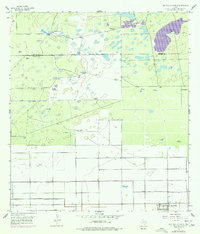
1956 Map of San Perlita North
USGS Topo · Published 1977About this map
Punta del Monte Ranch and the community of San Perlita anchor this coastal Texas landscape, where the flat terrain is defined by an intricate network of water management and cattle-ranching infrastructure. The map reveals the critical importance of water access in the mid-20th century, documented by numerous named wells and catchments such as Villarreals Artesian Well and Tanque los Cuates.
Find a feature on this map
28 named features on this map. Tap any name to fly to it.
Don’t see what you’re looking for? This feature index may not catch every label — zoom into the map to look around manually.
Map Details
Editions of this 1956 San Perlita North Map
2 editions found
Other maps of this area

1921 · Tarida Ranch
USGS Topo · 1:62,500

1922 · La Sal Vieja
USGS Topo · 1:62,500

1953 · Brownsville
USGS Topo · 1:250,000

1956 · Rudolph
USGS Topo · 1:24,000

1956 · San Perlita South
USGS Topo · 1:24,000

1956 · Rosita Lake
USGS Topo · 1:24,000

1956 · San Perlita North
USGS Topo · 1:24,000
1956 · Rosita Lake NE
USGS Topo · 1:24,000
1956 · Willamar
USGS Topo · 1:24,000

1956 · Yturria
USGS Topo · 1:24,000