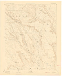
1893 Map of Sanborn
USGS Topo · Published 1925About this map
High plains cattle ranching and early settlement define this 1880s landscape across the borders of Lincoln, Elbert, and Otero counties. Surveyed by Willard D. Johnson and J. W. Hays, the map illustrates a sparsely populated territory where the primary landmarks are named homesteads and riparian corridors. Major watercourses like Horse Creek and its tributaries, including Little Horse Creek and Steel Fork, carve out the topography of the region, providing vital water for large operations like the Maryland Cattle Co Ranch and the Russell Ranch. The map captures the small hub of Sanborn at a time when the Western ranching economy was the primary driver of development. Notable landmarks such as Rocky Point and various unnamed ranch sites scattered near Rush Creek offer specific data points for genealogists and researchers tracing the history of open-range land use before more dense settlement occurred.
Find a feature on this map
14 named features on this map. Tap any name to fly to it.
Don’t see what you’re looking for? This feature index may not catch every label — zoom into the map to look around manually.
Map Details
Editions of this 1893 Sanborn Map
4 editions found

Other maps of this area

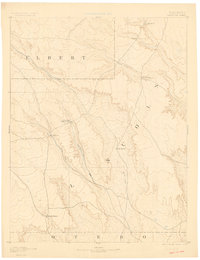
1889 · Sanborn
USGS Topo · 1:125,000

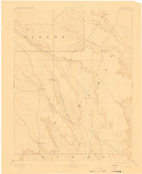
1891 · Sanborn
USGS Topo · 1:125,000

1891 · Catlin
USGS Topo · 1:125,000

1891 · Arroyo
USGS Topo · 1:125,000

1891 · Las Animas
USGS Topo · 1:125,000

1891 · Nepesta
USGS Topo · 1:125,000

1891 · Limon
USGS Topo · 1:125,000

1892 · Limon
USGS Topo · 1:125,000

1893 · Arroyo
USGS Topo · 1:125,000

1893 · Nepesta
USGS Topo · 1:125,000