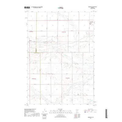
2019 Map of Sanborn NE
USGS Topo · Published 2019About this map
The Cottonwood River meanders across this prairie landscape where three Minnesota counties — Redwood, Brown, and Cottonwood — meet. This 2019 survey captures the rural layout near Sanborn and Springfield, showcasing a geography defined by the branching waters of Mound Cr and Coal Mine Cr. While much of the land is organized by an extensive grid of agricultural roads like Magnolia Ave and 450th Ave, the natural hydrology of the Little Cottonwood River in the southeast corner provides a distinct contrast to the straight-line section boundaries. Local heritage is grounded in landmarks like the Christ Lutheran Cem and the Springfield Municipal Airport, which serve as modern and historical anchors for the surrounding farming communities.
Find a feature on this map
41 named features on this map. Tap any name to fly to it.
Don’t see what you’re looking for? This feature index may not catch every label — zoom into the map to look around manually.
Map Details
Editions of this 2019 Sanborn NE Map
This is the sole edition of this map. No revisions or reprints were ever made.
Other maps of this area

1953 · Morgan
USGS Topo · 1:62,500

1953 · New Ulm
USGS Topo · 1:250,000

1957 · New Ulm
USGS Topo · 1:250,000

1958 · New Ulm
USGS Topo · 1:250,000

1967 · New Ulm
USGS Topo · 1:250,000

1967 · Wanda
USGS Topo · 1:24,000

1967 · Sanborn
USGS Topo · 1:24,000

1967 · Clements SE
USGS Topo · 1:24,000

1967 · Sanborn SE
USGS Topo · 1:24,000

1967 · Springfield
USGS Topo · 1:24,000