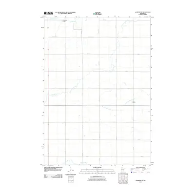
2010 Map of Sanborn SE
USGS Topo · Published 2010About this map
Red Rock Dells and the drainage of Mound Creek define the northern reaches of this rural landscape in Brown County, Minnesota. The terrain is characterized by a significant river network, where the Little Cottonwood River and the North Fork Watonwan River meander through a structured grid of agricultural roads. Local history is anchored at the Delton Cemetery, a prominent landmark located along the eastern portion of the survey area. In the south, the Watonwan River crosses the lower edge of the map, illustrating the importance of these waterways to the region's geography. The map provides a look at the intersection of nature and infrastructure, with County Hwy-10 and County Hwy-2 serving as the primary transportation arteries through this prairie river country.
Find a feature on this map
22 named features on this map. Tap any name to fly to it.
Don’t see what you’re looking for? This feature index may not catch every label — zoom into the map to look around manually.
Map Details
Editions of this 2010 Sanborn SE Map
This is the sole edition of this map. No revisions or reprints were ever made.
Other maps of this area

1953 · New Ulm
USGS Topo · 1:250,000

1954 · Fairmont
USGS Topo · 1:250,000

1957 · New Ulm
USGS Topo · 1:250,000

1958 · New Ulm
USGS Topo · 1:250,000

1958 · Fairmont
USGS Topo · 1:250,000

1967 · New Ulm
USGS Topo · 1:250,000

1967 · Sanborn
USGS Topo · 1:24,000

1967 · Sanborn SE
USGS Topo · 1:24,000

1967 · Springfield
USGS Topo · 1:24,000

1967 · Sanborn NE
USGS Topo · 1:24,000