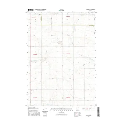
2016 Map of Sanborn SE
USGS Topo · Published 2016About this map
The Little Cottonwood River and the N Fork Watonwan River meander through this agricultural landscape along the border of Brown and Cottonwood counties. This 2016 survey highlights a region defined by its waterway network, including Mound Cr and the main branch of the Watonwan River near the southern boundary. Culturally, the presence of the Delton Cem provides a specific point of interest for genealogists and local historians tracking family roots in the township. The terrain is marked by the Red Rock Dells in the northern portion, suggesting a break in the uniform prairie topography. A dense grid of rural roads, such as Co HWY 17 and Co RD 51, connects the various sections and townships, illustrating the persistent land division patterns of the Public Land Survey System.
Find a feature on this map
26 named features on this map. Tap any name to fly to it.
Don’t see what you’re looking for? This feature index may not catch every label — zoom into the map to look around manually.
Map Details
Editions of this 2016 Sanborn SE Map
This is the sole edition of this map. No revisions or reprints were ever made.
Other maps of this area

1953 · New Ulm
USGS Topo · 1:250,000

1954 · Fairmont
USGS Topo · 1:250,000

1957 · New Ulm
USGS Topo · 1:250,000

1958 · New Ulm
USGS Topo · 1:250,000

1958 · Fairmont
USGS Topo · 1:250,000

1967 · New Ulm
USGS Topo · 1:250,000

1967 · Sanborn
USGS Topo · 1:24,000

1967 · Sanborn SE
USGS Topo · 1:24,000

1967 · Springfield
USGS Topo · 1:24,000

1967 · Sanborn NE
USGS Topo · 1:24,000